Saturday, September 29, 2012

Searching for a Good Camera

"Just throw it! I'll take a picture of you." Julia is swimming deep offshore in Laguna Atitlan. I'm diving off something or other.

"It'll sink if we miss it," I've been here before. This camera has history. There has been more than one rescue from the bowels of a water body.

"Don't miss." She has come in closer now. Egg beater with both hands ready to receive.

I draw back my arm. Take a step forward and swing the camera in a gentle arch. I even remember adjusting for the wind. The camera sails through the air. Short! It's a terrible toss. Two feet short of the target. Kerglunkah.

Julia chases the flickering reflection of the camera screen as it sinks but thick weeds halt her pursuit after a little over a meter. We exchange glances and some laughter at the most unfortunate of "Told ya so"s.  Some naked children see the blunder and come to lend a hand with the rescue. They rely on vision - but it's too dark to see down there.

We begin a grid search using only touch on the bottom of the lake. Lots of weeds and a beer can. Hopeless. I excavate a 3m x 3m square over a period of about an hour. It's more than 200 lbs of water soaked vegetation. Then start to search in the dark using touch.

Search

All of the photos from the trip are lost! I'm kicking myself. Stupid. At least I have my cellphone camera.

Twenty minutes pass. The lake is landlocked stagnant water with no rivers out. The ground is covered in cans and  there is a small recess in the middle of the search zone where the garbage gets really deep. Gross.

But it's here somewhere!

The sun departs behind thick clouds and soon it's raining. I'm out of breath and shivering in the cold. I've been over this grid so many times. Despair.

An hour in this garbage and Julia arrives with a diving mask, a snorkel, and rejuvenated hope.
Another half hour and we have given up. But you can see almost a foot with the mask - which is a great help. Just one more search.
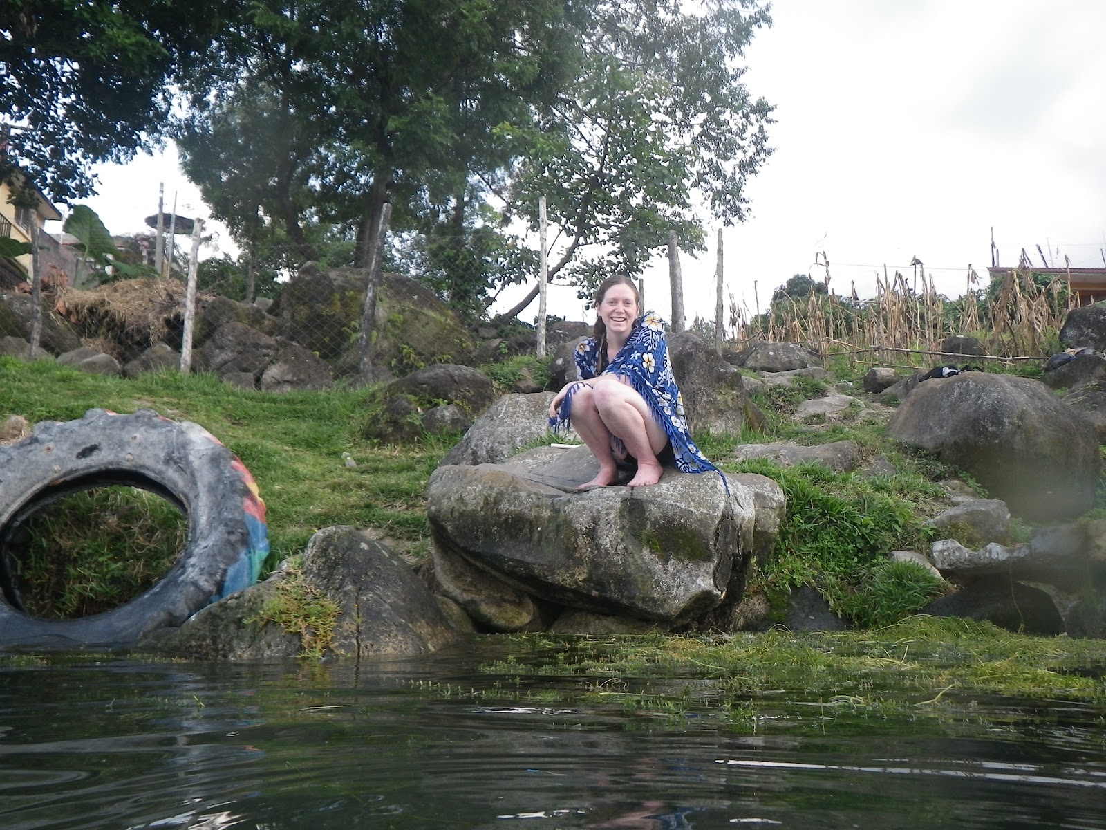
I came up out of the water shooting with a happy Julia!

Mask and some of the weeds.


One cold rescuer.

Thursday, September 27, 2012

Guatemala Motocicleta - San Pedro á la Laguna

Road trip! Guatemala style.

Trees and vines and dirt fly past our heads. Julia is on the back of the motorcycle hugging me with both arms and both legs tight at my waist. I'm in the driver's seat on the fringe of control. In the flow state. She says "careful" with her tightening grip as we take a tight corner. Just another school bus oncoming towards us. This time the bus is using all of our lane except for the width of one motorcycle. We find the hole.

After six days in Central America we finally settled on a plan, a country, a route. El Salvador had the cheapest flights. Then it took a few days surfing in El Tunco and a few more in transit before we found a home in Antigua, Guatemala. Then we just waited to be inspired.

On our second day in Antigua, we were looking to purchase a motorcycle. If we could arrange a good deal for a good bike, we would learn to ride it. The folks at CaTours helped us meet ex pats in Antigua with motorbikes and eventually we were able to arrange a rental with a fellow Vancouverite living in Antigua. Check out this sick DR 250 S Suzuki. There's off road tires, and enough seat for two. Kick start only. No luxuries.
Kenn poses with the candidate bike on our first meeting.
We were eager to depart for a circuit which would take us into the highlands, to the northern jungles, and then back south along the Caribbean coast. But neither of us have ridden a bike and Julia hasn't handled a manual transmission. We had an incredible instructor from Quebec who prepared us over a span of two days. Thanks Frenchie!
Posing on the second day lesson. Up on some volcano somewhere.
Our bags were too heavy, so we trimmed the fat and dropped two thirds of our stuff. Just the essentials - and the Frisbee.

After we graduate, we depart at 10 am sharp. First stop is San Pedro á la Laguna - a chill hangout in the Guatemalan highlands nestled on the far corner of Laguna Atitlan. Chaotic traffic and absent road signs kept us on our toes as we found the Pan-American highway and cruised more than 18 kilómetros beyond our first turn-off. Regresamos!
Random road
Soon we are cruising through the volcanic highlands towards Laguna Atitlan. The twisting pavement is a biker's dream. We reach a river crossing where the bridge has been washed away. No problems. Vroom vroom as we take the river head on.

No bridge!
Cruising on dirt roads we take a hard corner where recent erosion has moved the dirt into a small wall. We don't see it until it is too late. Emergency braking procedures!! But the back wheel locks and Julia starts to slide out sideways. I release the brake and we take the bump head on at reduced speed. It went well. But a scare.

We get our first views of the lake and soon reach Panachel and find a nice break at the local fair.

Then we reach Solola and decide to push through impending storm rains and take a faint dirt road along the north side of the lake through small rural towns, several dead ends, and another river crossing. When we reach Utatlan, we decide to keep pushing on despite impending nightfall. San Pedro or bust!


With the sun setting we reach yet another small town named after yet another saint and ask, "How far to San Pedro?" In a five-minute Spanglish conversation we decipher that San Pedro is 48 kilómetros back in the direction we came from ... then a second villager confirms it, "Caraterra termino" - the road is out.

It has been a great first day out on the bike so we abandon hopes of reaching San Pedro today and race the setting sun back east to anywhere with a room for the night. In Utatlan we settle into Hostalaje Universal well after dark. Then we hit the town and enjoy some delicious corn husks stuffed with potato and chicken in the local plaza.

So ends our first day on the roads of Guatemala.
Tomorrow, Julia is driving! Gulp.

Monday, August 27, 2012

Monmouth Creek - Day 2

We had a grand-ol’ time crossing the Squamish River on Day 1 but forgot our map and our printed copy of the trail. We decided to take the crossing a tad bit seriously here on Day 2, and so we would swim across the river towing our gear behind us in dry bags. It is a glacial river (freakin’ freezing) and so we’d have to rent a wetsuit for Julia. We would learn late in the second morning that you can’t really rent a wetsuit in Squamish and that the friendly staff at Valhalla Pure strongly recommends against swimming across a river with so many hidden dead heads and sweepers. We listened, and thought their comments oddly applicable to a river crossing based on a stratagem of inflatables. We rented a kayak.

The crossing went smoothly.

We knew the trail generally follows a creek up the side of a steep face. We had a written description of the trail and a topographical map of the region, but no map which actually showed the trail. So we approached the creek from the south and then followed a bunch of empty creek beds up to eventually find the creek. Once we had the creek, we waded up it until we found the first waterfalls. All the information required to complete this hike without wading or bushwhacking is readily available online or from Valhalla Pure in Squamish, but it was actually quite good fun to wander our way through the flood plains.

Now it was just following a very nice trail up and up through an endless series of waterfalls. It was really the nicest hiking I’ve ever done around Vancouver.

Some shots of the waterfalls:

This one was really cool! The water has carved a deep tunnel in the rock peering through the tunnel there is just an eruption of waterfalls at the back of it.  I can’t wait to come back and see this one when the water is really high.


Eventually we found the arch. I had read about it online but not seen it. The water has formed a really smooth tunnel through quite a long span of granite and left some amazing features unlike anything I’ve ever seen. We had a great dip here.


And the climber in me just had to go out onto the arch and take a closer look. Some dirty 5.6 moves getting out here, but I really felt happy sitting there on the arch. Truly a great moment!


For me, it was a beautiful swim home. Epic shot here from Julia in the kayak who navigated well in the high winds.

Monmouth Creek – Day 1

I was on The Chief alone when I met a cheerful man who was about to jump off the cliff I was climbing on. He was aiming to paraglide on a little 20 lbs glider, but the wind wasn’t quite right and so we were wasting some time together. We had a nice chat and as he was leaving he pointed into the Tantalus Range and singled out a small peak across the Squamish River. “Best day hike you’ll ever find. You really have to go there.”

I looked into it and found a hike which followed a creek up to Echo Lake. Maps indicated what was obviously visible from my vantage in Squamish – steeps granite with many narrow waterfalls. Gathering information through word of mouth was difficult. Most people entering the Tantalus Range from Squamish do so via the logging roads far down river. I need to get to the west bank where the river empties into the Howe Sound, and this region is accessed only by boat. Not insurmountable, but it means that despite the incredible proximity to the main highway the hike is not broadly known.

Julia had some time off work and she suggested that we attempt the river crossing “on the cheap.” We would buy an inflatable two-man boat from Walmart ($9) and an inflatable Orca Whale ($8) and load up the whale like a pack mule with enough stuff for two nights of camping.  We giggled furiously at the idea – and so it was on! Stoke factor high.

Trouble erupted when Walmart, Canadian Tire, and London Drugs were all sold out of inflatable boats. We had a downtrodden walk on which we mourned the loss of our plan and discussed alternatives. Perhaps renting a kayak for the three days? We decided on a risky option – to buy a Four-in-One Double Queen-Size Inflatable Air Bed from Walmart ($110) with plans to return it for a full refund. It would be a real gamble.


Ready to embark:


Epic shot


At the far side of the river:

Mission Status: Amusing Failure

Wednesday, August 15, 2012

Sky Walker's Traverse


Julia came up from Vancouver on her day off and I took her out for her first big climb in many years. At the top of the climb we swam in the pools and waterfalls right before the river plunges down 200 meters off the side of the cliff we just climbed.

Pool bathing and waterfall showering


Some folks had a very impressive highline set here above the falls – wasn’t enough time for me to get on it L But this guy was really good.


Friday, August 10, 2012

Chasing the Top 100 in Squamish (Angel's Crest)

I took this time off for a variety of reasons: mostly just to take a break and poke around; but maybe scope out some next steps in my life. Definitely, I want to spend time thinking about problems which are not computer related and to experiment with some different lifestyles.

On my first sabbatical I travelled thousands of kilometers and visited thirteen different countries on three continents. It was a great experience but at the end I was left wishing that I had invested more in relationships  and wished that I had taken the time to explore places more deeply. There would surely be a tradeoff - meeting fewer people and seeing fewer places – but I'm sure it is the right way to do things this time around. So my goals for this sabbatical are focusing on fewer pursuits, smaller distances, and increased depth.

After returning from the Sunshine Coast I had a very mellow birthday with friends and the new Batman movie. Thanks to everybody (both local and remote) for a great day (even though the movie was crappy).

I loaned my only pair of house keys to a friend and he unfortunately took them on his trip home to Ontario, so I was locked out of my house for about six days. I embraced this and decided to get deeper into climbing and head up to Canada’s most popular climbing destination: just an hour’s drive to Squamish.

I'm playing around with a recently published list of Squamish’s best 100 climbs - called the Squamish Top 100. They are distributed across a variety of difficulties and many different climbing areas, so it really encourages quite a bit of exploration. I roughly go for one per day and explore the area around it.


Tim and I started the exploration on the first weekend with Angel’s Crest. This is about a 500 meter climb which using traditional protection up a crest to the summit of the Stawamus Chief climbing at 10b. It is one of my favourite long routes from the ground to the top of the chief. 

Tim leading Angel's Crack (10b)
Kenn leading on Angel's Crest (10b)


Tim and I have some history on this climb. We tried this route for the first time two years starting at 5am and accidentally walked beyond the start of the climb until we found a different but similar looking climb. We followed our noses up and up for over twenty hours of wild and dirty climbing and when we finished (well after midnight) we thought we had completed Angel’s Crest “give or take a pitch or two”. Two weeks later we figured out that we wandered into a totally separate gully system and climbed a line up the infamously dirty North-North Arête.

In stark contrast to our first attempt, our climb this week went smoothly. In fact, the crux pitches felt relatively casual for the grade and we finished the route with enough light for a swim as the sun went down. Great day!

Don't have a good summit shot of the both of us - but have one good one of each of us. This has made me really excited for a few weeks in Squamish exploring new vertical terrain - just one hour’s drive from my house!


Tuesday, August 7, 2012

Sunshine Coast - Desolation Sound Kayaking

Three days kayaking, fishing, and snorkeling through the Desolation Sound - a beautiful marine wildlife reserve on the north of the Sunshine Coast.


We camped on our own private island the first night right in the heart of the sound. Eagle feathers, seals, and dolphins.

And found a pretty amazing spot to settle in and roast up some veggies on the second night.

Pictures by Uwe. See more here.