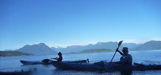
The crossing went smoothly.
We knew the trail generally follows a creek up the side of a steep face. We had a written description of the trail and a topographical map of the region, but no map which actually showed the trail. So we approached the creek from the south and then followed a bunch of empty creek beds up to eventually find the creek. Once we had the creek, we waded up it until we found the first waterfalls. All the information required to complete this hike without wading or bushwhacking is readily available online or from Valhalla Pure in Squamish, but it was actually quite good fun to wander our way through the flood plains.
Now it was just following a very nice trail up and up through an endless series of waterfalls. It was really the nicest hiking I’ve ever done around Vancouver.
Some shots of the waterfalls:
Eventually we found the arch. I had read about it online but not seen it. The water has formed a really smooth tunnel through quite a long span of granite and left some amazing features unlike anything I’ve ever seen. We had a great dip here.
And the climber in me just had to go out onto the arch and take a closer look. Some dirty 5.6 moves getting out here, but I really felt happy sitting there on the arch. Truly a great moment!
For me, it was a beautiful swim home. Epic shot here from Julia in the kayak who navigated well in the high winds.


